Other news as I have exclaimated before was that I was able to get my terrain model to work with minimal errors and it looks tight! Essentially its a wetness index describing potential moisture due to topograghy ie. ridges are driest, steep slopes are dry and convergent drainages are moist and flater areas are moist due to expected saturation. This will be combined with Aspect to make north facing slopes wetter and south facing slopes drier due to solar exposure or insolation. Im not sure this will make sense so Ive included some reference images:
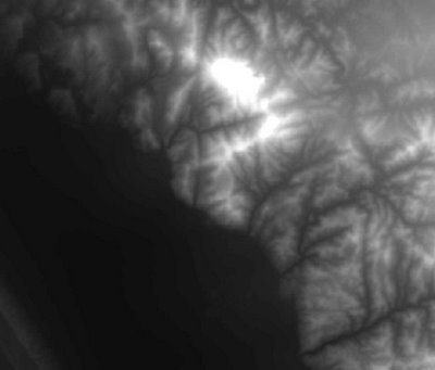
This first one is an elevation grid: white is high, dark is low
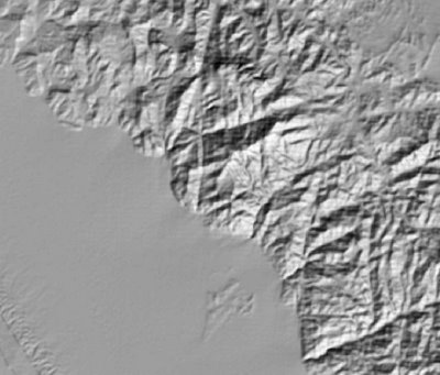
This is a hillshade, so you see the shape of the moutnains, imagine youre looking from above and the sun is at 4:30 on the sundial
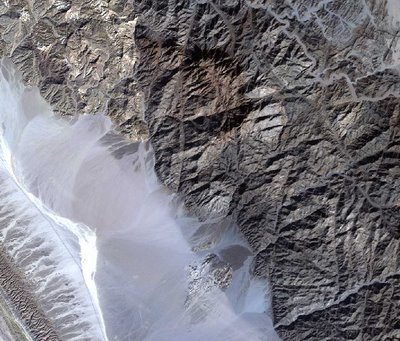
This is a Landsat7 ETM+ image showing you an actual color of the area. By now you can notice the topright portion is mountainous and the lowerleft is a huge sandy washout. By the way this is a south western clip of the Sinai, the gulf of Suez is just out to the left.
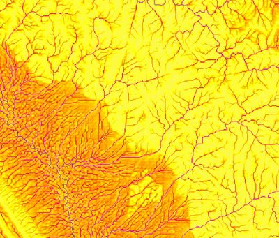
This is the Wetness Index using a flow algorithm FD8 as modified by "Quinn". Notice that the color scheme is yellow-red-blue or dry-moist-more moist. I think its pretty sweetasaurus.
3 comments:
I'm with you........cool!.....hey I see it!.....by the way. What the heck are we going to do with this info when it is finished?
so then this gives a good place to start looking for potential vegetation and wildlife... and JP, you need to send me an email, cuz yours doesnt work I think?
Keith...I love the maps..you ROCK! I am glad you are enjoying your work...it is interesting. Happy Spring over there!
love, pam
Post a Comment